Forest identity & boundaries
Forest name, mapped management boundary, forest type, ecological zone and area.
 A shared climate future
A place-specific foundation for forest partnerships, evidence and long-term stewardship.
Districts: Bhaktapur · Chitawan · Dhading · Dolakha · Kathmandu · Kavrepalanchok · Lalitpur · Makwanpur · Nuwakot · Ramechhap · Rasuwa · Sindhuli · Sindhupalchok
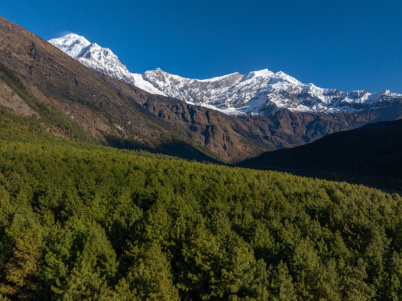
Bagmati Province is the third province of Nepal, created under the 2015 constitution. Its official name is Bagmati Province and its provincial capital is Hetauda. The province stretches from the high Himalaya in the north (Langtang, Gaurishankar, Jugal ranges) through the mid-hills and the Kathmandu Valley to the inner-Terai and Chure (Siwalik) foothills in the south. It is bordered by Tibet (China) to the north, Koshi Province to the east, Madhesh Province to the south, and Gandaki Province to the west.
The province contains Nepal's capital Kathmandu, the Kathmandu Valley cultural world-heritage complex, and the country's main economic, administrative, educational and aviation hubs. It also includes some of the most disaster-prone districts in Nepal, notably Sindhupalchok and Dolakha.
Number of districts: 13
Number of municipalities: 119 (3 Metropolitan Cities, 1 Sub-Metropolitan City, 41 Municipalities, 74 Rural Municipalities)
Estimated total population (2021 Census, sum of municipalities): 6,021,003
Forest cover ranges from dense mid-hill and Himalayan forests in Rasuwa, Sindhupalchok, Dolakha, Nuwakot and Kavrepalanchok to highly fragmented urban vegetation in Kathmandu, Lalitpur and Bhaktapur. Community forestry is widespread in the mid-hills. Protected areas include Shivapuri-Nagarjun National Park, Langtang National Park (with buffer zones in Rasuwa and Nuwakot), Chitwan National Park (buffer in Chitwan/Makwanpur), and Gaurishankar Conservation Area (Dolakha). Carbon sequestration potential is highest in the community forests of the mid-hills and the protected high-mountain ecosystems; REDD+ and watershed-payment schemes are relevant but not yet scaled across the province.
Agriculture varies by elevation. Terai and inner-Terai districts (Chitwan, Makwanpur, Sindhuli) produce paddy, wheat, maize, vegetables, oilseeds and commercial dairy/poultry. The Kathmandu Valley has intensive peri-urban vegetable, dairy and floriculture systems. Mid-hill districts grow maize, millet, wheat, potato, ginger and vegetables. High-mountain districts (Rasuwa, northern Dolakha/Sindhupalchok) focus on potato, barley, buckwheat and yak/chauri pastoralism. Irrigation, market access and land fragmentation are the main constraints.
Open a district to read its landscape and forestry background.
Bhimeshwar Temple and Charikot (district headquarters), Jiri - gateway for Everest trekking and Switzerland of Nepal, Gaurishankar Conservation Area and Rolwaling Himal, Kalinchok Bhagawati pilgrimage site, Tamakoshi River hydropower projects
Gaurishankar Conservation Area and community forests provide alpine, temperate and sub-tropical forest cover. Significant carbon storage in temperate oak-rhododendron forests. Biodiversity includes red panda, snow leopard habitat.
Chautara Sangachokgadhi - district headquarters, Helambu and Panchpokhari trekking routes, Melamchi Water Supply Project for Kathmandu, Bhotekoshi River rafting and bungee jumping, Tatopani border crossing to Tibet-China
Extensive mid-hill and high-elevation forests; Jugal Himal area has biodiversity and carbon value. Community forestry widespread. Melamchi watershed is critical for Kathmandu.
Langtang National Park and Langtang Valley trekking, Gosaikunda Lake - sacred alpine pilgrimage site, Rasuwa Gadhi - Tibet-China border trading post, Tamang heritage trails and culture, Kyirong (Gyirong) border and transit trade
Langtang National Park contains alpine meadows, rhododendron and conifer forests with significant carbon storage. GLOF and landslide risks affect forests. Community forestry limited at high altitude.
Gateway district between Kathmandu Valley and the mid-hills, Gangajamuna and Rubi Valley trekking areas, Historic Nuwakot-Dhading trade route, Dhunibesi (district headquarters) and Benighat bazaar, Organic coffee and ginger production areas
Mixed forest cover in mid-hills with community forestry groups; northern areas have higher biomass and biodiversity. Carbon sequestration potential in degraded mid-hill forests. REDD+ readiness at provincial level may benefit community forests.
Nuwakot Durbar / Seven-storey palace of King Prithvi Narayan Shah, Trishuli River rafting and Kakani hill station, Historical unification-era fort and bazaar, Bidur - district headquarters and bazaar town, Shivapuri watershed and Kathmandu water supply
Shivapuri-Nagarjun National Park and community forests provide significant watershed and carbon services. High biodiversity; red panda habitat in northern forests.
Capital and largest city of Nepal, UNESCO World Heritage Sites: Pashupatinath, Swayambhunath, Boudhanath, Kathmandu Durbar Square, Political, administrative, educational and economic center, Tribhuvan International Airport, Thamel tourism and nightlife district
Very low natural forest cover; urban green spaces (Raniban, Shivapuri-Nagarjun National Park fringe) provide limited carbon sequestration. Nagarjun and Shivapuri forests on municipality fringes are important for water supply and biodiversity.
Bhaktapur Durbar Square (UNESCO World Heritage Site), Newar art, architecture and pottery, Juju Dhau (king curd) and traditional festivals, Medieval city planning and peacock window
Low forest cover due to dense settlement; urban greening and heritage garden conservation are priorities. Carbon sequestration potential is limited at district scale; focus is on urban tree cover and heritage site management.
Patan Durbar Square (UNESCO World Heritage Site) and fine metalwork, UNESCO World Heritage Site: Patan Durbar Square, Pulchowk Engineering Campus and IT park, Godawari Botanical Garden and Phulchowki hill, Satdobato, Kupondole and Sanepa commercial/residential areas
Phulchowki forest and Godawari Botanical Garden provide important urban biodiversity and carbon storage. Urban green cover is under pressure.
Dhulikhel - panoramic Himalayan views and wellness tourism, Namobuddha - important Buddhist pilgrimage site, Panauti - historic Newar town and Indreswar Temple, Banepa - historic trade town and education hub, Panchkhal military and cantonment area
Moderate-to-high forest cover in Mahabharat and mid-hill ranges; community forestry is well established. Carbon sequestration potential in degraded forests. Biodiversity corridors connecting Kathmandu Valley and mid-hills.
Manthali - district headquarters and Tamakoshi corridor town, Likhu and Tamakoshi river valleys, Sunapati and Doramba cultural landscapes, Access point for Rolwaling and Everest region, Traditional hill agriculture and terrace systems
Temperate and sub-tropical community forests cover significant areas. Carbon sequestration potential in degraded forests. Biodiversity data limited.
Kamalamai (Sindhulimadi) - district headquarters, Sindhuli Gadhi - historic fort from Anglo-Nepal War, Sunkoshi and Kamala river valleys, Strategic location on BP Highway (Kathmandu-Terai), Dudhauli bazaar and commercial center
Chure (Siwalik) forests and mid-hill community forests. Carbon sequestration potential in degraded Chure areas; watershed conservation critical for flood control.
Hetauda - provincial capital of Bagmati, industrial city, Makwanpur Gadhi historical fort, Indrasarovar Lake (Kulekhani) and Markhu tourism, Chitwan National Park buffer zone in eastern Makwanpur, Hetauda Cement Factory and industrial corridor
Significant forest cover in Chure (Siwalik) and mid-hills; community forestry active. Carbon sequestration potential in degraded Chure forests. Biodiversity corridors link Chitwan and Parsa.
Chitwan National Park (UNESCO World Heritage Site) and rhino conservation, Bharatpur - medical city and commercial hub, Elephant safaris, jungle lodges and biodiversity tourism, Narayani River and Rapti River ecosystems, Devghat religious site
Chitwan National Park and buffer-zone community forests provide substantial biodiversity and carbon storage. Community forestry and buffer-zone management are active. High carbon sequestration potential in sal forests and wetlands; human-elephant conflict constrains expansion.
Each participating forest will have its own record, distinct from the background research above. The following information needs to be established before a project can be assessed.
Forest name, mapped management boundary, forest type, ecological zone and area.
Management institution, community forest user group, tenure, operational plan and benefit-sharing arrangements.
Species composition, age structure, canopy, growing stock, biodiversity and disturbance history.
Inventory plots, baseline management, biomass and soil pools, methodology, uncertainty and monitoring schedule.
Consent, livelihoods, inclusion, grievance mechanism, fire risk, leakage and permanence planning.
Proposed activities, budget, implementing partners, agreements, field photographs and verification documents.
Choose a province to explore its forest context and the evidence needed for project development.
Loading Nepal’s boundaries…
Selected area · click a boundary to explore58.62% forest cover · 2022 land-cover baseline
Explore a landscape baseline and start a conversation.Share maps, available records and local priorities with the team. Data will need review before it can become a published project record; these pages do not imply eligibility, verified carbon volumes or an existing agreement.
Discuss Bagmati