Forest identity & boundaries
Forest name, mapped management boundary, forest type, ecological zone and area.
 A shared climate future
A place-specific foundation for forest partnerships, evidence and long-term stewardship.
Districts: Baglung · Gorkha · Kaski · Lamjung · Manang · Mustang · Myagdi · Nawalparasi East · Parbat · Syangja · Tanahu
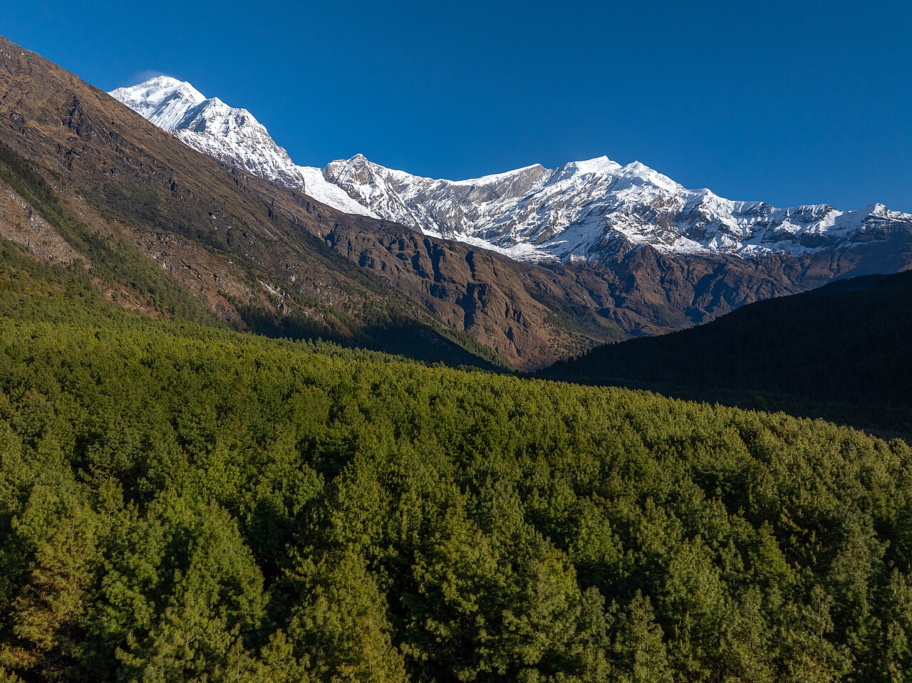
Province 4 of Nepal is Gandaki Province (Nepali: गण्डकी प्रदेश), located in central-western Nepal. It was formed under Nepal's 2015 federal constitution and comprises 11 districts and 85 local levels (municipalities/rural municipalities). The province stretches from the tropical inner-Terai and Churia foothills in the south to the high Himalaya and Tibetan plateau in the north, encompassing the entire Kali Gandaki, Marsyangdi, Budhi Gandaki, Seti, Trishuli and Modi river systems.
Gandaki contains two of Nepal's largest conservation areas — Annapurna Conservation Area and Manaslu Conservation Area — plus parts of Dhorpatan Hunting Reserve and the Chitwan National Park buffer zone (Nawalpur). Forest cover ranges from dense sub-tropical sal and mixed broadleaf in the south to pine, rhododendron, oak and alpine scrub in the north.
Agriculture remains the main livelihood for the majority of the population outside Pokhara and the highway towns. The altitudinal range produces:
Key commercial opportunities include off-season vegetables, citrus branding, ginger/turmeric value chains, dairy and poultry commercialisation, organic/heritage products, and apple processing.
Open a district to read its landscape and forestry background.
Birthplace of King Prithvi Narayan Shah and the historic Gorkha Durbar, Epicentre of the 25 April 2015 M7.8 Gorkha earthquake, Manaslu Conservation Area and Manaslu Circuit trekking, Tsum Nubri valley (Tibetan Buddhist cultural landscape), Larkya La pass and high Himalayan peaks
Manaslu Conservation Area and parts of Annapurna Conservation Area cover the northern high Himalaya, storing significant carbon in alpine forests, grasslands and peatlands. Mid-hill community forests are widespread. High carbon sequestration potential through reforestation of earthquake-induced degraded slopes and community forestry expansion. REDD+ readiness exists at national level but municipality-specific projects are limited.
Annapurna Circuit and Thorong La pass (5,416 m), Tilicho Lake (one of the world's highest lakes), Unique Tibetan Buddhist culture, gompas and monasteries, High-altitude pastoralism and yak cheese (Chame, Yak Kharka), Restricted-area trekking (Nar-Phu valley)
Annapurna Conservation Area covers the entire district, protecting alpine meadows, scrub, birch/rhododendron forests and high-altitude wetlands. Very high carbon storage per unit area in peatlands and alpine soils, though total biomass is lower than lowland forests. Community management of grazing lands and forests is critical. Climate change and overgrazing are threats.
Gateway to the Annapurna Circuit (Besisahar trailhead), Marsyangdi River valley and hydropower projects (Marsyangdi corridor), Historic Lamjung Durbar / royal palace heritage, Ghorepani-Poon Hill, Nar-Phu and Manang trekking approaches, Organic ginger, turmeric and honey production
Mixed broadleaf, chir pine and rhododendron forests cover the mid-hills; sub-alpine forests at higher elevations. Community forestry is active in populated areas. Annapurna Conservation Area borders the north. Carbon sequestration potential through slope stabilisation, community forest management and agroforestry. No verified REDD+ projects at municipality level documented.
Pokhara - tourism capital of Nepal, gateway to Annapurna Circuit, Phewa, Begnas and Rupa lakes, Annapurna and Machhapuchhre mountain views, World Peace Pagoda, Bindhyabasini Temple, Davis Falls, International Mountain Museum and adventure sports hub
Annapurna Conservation Area covers much of the district's north, with community-managed forests and tourism-revenue sharing. Mid-hill forests around Pokhara are important for watershed protection and carbon storage. Community forestry and private agroforestry are well established. Carbon sequestration potential exists in degraded areas and through sustainable tourism-linked conservation.
Devghat - sacred confluence of Kaligandaki and Trishuli rivers, Bandipur - preserved Newari hill-top town and heritage tourism, Bhanu Bhakta Acharya (national poet) birthplace (Chundi Ramgha), Seti River, Madi River and Marshyangdi corridors, Manakamana cable car (border with Gorkha/Lamjung)
Mixed broadleaf and pine forests cover mid-hills and Churia slopes. Community forestry and leasehold forestry are active. Devghat area has sacred groves. Carbon sequestration potential through river-bank plantation, community forest management and agroforestry. Biodiversity links to Annapurna Conservation Area in the north.
Waling orange (Waling is known as 'Orange City'), Historic Chapakot and Galyang kingdoms, Seti dam and hydropower heritage, Scenic mid-hill landscape and trekking routes (Madi valley), Remittance-driven economy and diaspora networks
Well-forested mid-hills with community forestry networks. Forests range from sal and mixed broadleaf at lower elevations to pine and rhododendron higher up. Strong carbon sequestration potential through community forest management, agroforestry and slope conservation. Biodiversity includes leopard, bear, barking deer and pheasants.
Kaligandaki River gorge and corridor, Bhakunde, Gaja and Dhorpatan hunting reserve access, Historic Baglung bazaar / trade hub on mid-hill highway, Suspension bridges (including one of Nepal's longest mid-hill spans), Religious sites: Baglung Kalika Temple, Panchakot
Mixed broadleaf and pine forests cover significant upper-hill areas; community forestry is active around populated mid-hills. Carbon sequestration potential lies in degraded-hill restoration and agroforestry. Dhorpatan Hunting Reserve extends into the district, conserving alpine/sub-alpine biodiversity. No large REDD+ project documented; community forests provide fuelwood, fodder and non-timber forest products (NTFPs).
Upper Mustang / Lo Manthang - former Kingdom of Lo, Trans-Himalayan landscape, desert canyons and caves, Muktinath Temple (sacred to Hindus and Buddhists), Jomsom airport and gateway to Annapurna Circuit, Ancient monasteries, chortens and Tibetan culture
Mustang lies in the rain shadow; vegetation is sparse (juniper, birch, willow, alpine scrub). Annapurna Conservation Area covers the southern part. Carbon storage is modest in biomass but significant in high-altitude soils. High solar/wind renewable energy potential supports low-carbon development. Biodiversity includes snow leopard, blue sheep and migratory birds.
Kushma bazaar and the Modi River gorge, Suspension bridges including one of Nepal's highest bungee/canyon swing sites, Hill-top agriculture and orange/mandarin production, Religious sites: Shaligram (Kaligandaki), Gupteshwor and Siddha caves, Cleanest district recognition and sanitation campaign
Dense mid-hill forests (pine, broadleaf) provide significant carbon stock and watershed services. Community forestry is well established and award-winning in some VDCs. Carbon sequestration potential through community forest management, reforestation of degraded slopes and private agroforestry. Modi river corridor is important for biodiversity.
Dhaulagiri massif and Annapurna Conservation Area, Beni-Jomsom corridor and Rupse waterfall, Gurja Himal, Dhaulagiri base camp trekking approaches, Marpha apple brandy and trans-Himalayan trade route proximity, Hot springs (Tatopani) and Kaligandaki gorge
Annapurna Conservation Area covers northern Myagdi; community forests and leasehold forests exist in mid-hills. Forest types range from sub-tropical sal to temperate broadleaf and high-altitude scrub. Carbon sequestration potential through community forest restoration, agroforestry and watershed protection. Biodiversity includes red panda, leopard, bear and numerous bird species.
Daunne hill (historical and religious site), Narayani and East-West Highway trade corridor, Chitwan-Butwal industrial/service corridor extension, Mixed Terai-inner-Terai agriculture and settlements, Proximity to Chitwan National Park buffer zone
Churia/Siwalik forests in the south, mixed hardwood forests in the north. Forest coverage is lower than hill districts but significant in Churia range. Community and collaborative forestry programs exist. Carbon sequestration potential through Churia restoration, agroforestry and community forest management. Biodiversity links to Chitwan National Park ecosystem.
Each participating forest will have its own record, distinct from the background research above. The following information needs to be established before a project can be assessed.
Forest name, mapped management boundary, forest type, ecological zone and area.
Management institution, community forest user group, tenure, operational plan and benefit-sharing arrangements.
Species composition, age structure, canopy, growing stock, biodiversity and disturbance history.
Inventory plots, baseline management, biomass and soil pools, methodology, uncertainty and monitoring schedule.
Consent, livelihoods, inclusion, grievance mechanism, fire risk, leakage and permanence planning.
Proposed activities, budget, implementing partners, agreements, field photographs and verification documents.
Choose a province to explore its forest context and the evidence needed for project development.
Loading Nepal’s boundaries…
Selected area · click a boundary to explore37.98% forest cover · 2022 land-cover baseline
Explore a landscape baseline and start a conversation.Share maps, available records and local priorities with the team. Data will need review before it can become a published project record; these pages do not imply eligibility, verified carbon volumes or an existing agreement.
Discuss Gandaki